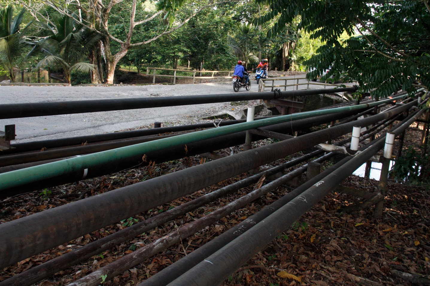
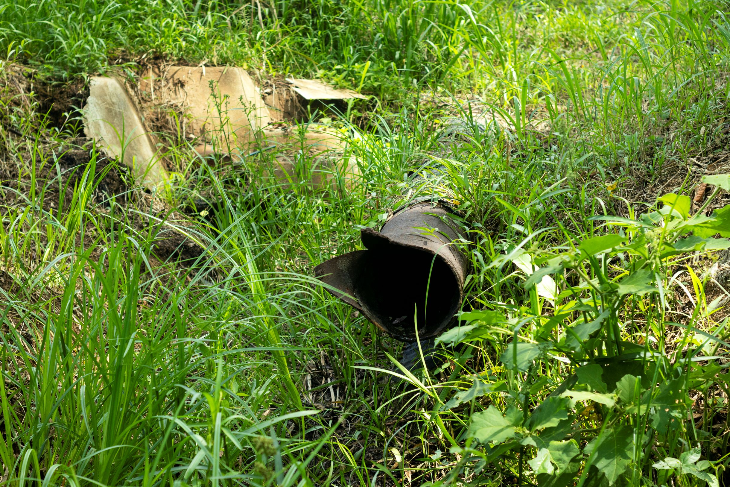
More than 2,800 kilometers (1,740 miles) of pipelines run through the Amazon and along the coasts of Peru, Bolivia, Ecuador and Colombia. These hundreds of pipelines transport millions of liters of crude oil from the most delicate ecosystems through to the cargo ships that will transport them to their final destination. Along the way, in this pipeline jungle, there have been more than 3,000 spills that have affected thousands of local and Indigenous communities, as reported in our special series Manchados por el Petróleo (Stained By Oil).
In an attempt to learn more about the environmental cost of these spills, we mapped the environmental liabilities reported by the countries’ environmental agencies between 2012 and 2022. The findings are alarming. As many as 4,284 contamination sites can be found scattered across Bolivia, Ecuador and Peru. But that figure is almost doubled if we take into account the 3,994 instances of oil damage that are not classed as environmental liabilities but that are in many ways similar due to the damage they cause.
Where exactly are these spills located and who is most affected? To answer these questions, we plotted the area’s environmental liabilities and oil damage sites according to coordinates provided by the four national environment agencies. This showed that 109 spill sites overlap with 15 protected natural areas in Colombia, Bolivia, Ecuador and Peru, and that 561 environmental liabilities are located in 50 Indigenous communities.
If we also include the contamination sites located up to 1 km (0.6 mi) from these territories, the figure rises to 1,681 contamination and other oil damage sites in and around 20 natural reserves and 90 Indigenous communities.
Biologist Jazmín Arias, lecturer in environment and development at the National University of Colombia and expert in social and ecosystem conflicts, explains the importance of monitoring the “potential impacts” of oil waste, both in and around protected territories. “These contaminants close to protected areas could reach the water sources that supply populations or ecosystems. When it rains, debris from solid oil waste left out in the open air can cause leachates [contaminated liquid generated from water passing through solid waste]. Those oxides then go into the soil, or even into bodies of water. Using this data, we are able to predict the environmental and sanitary consequences and try to mitigate against them,” she says.
Armed with this information, journalists from Mongabay Latam, Colombia’s Rutas del Conflicto and Cuestión Pública, Ecuador’s La Barra Espaciadora and Bolivia’s El Deber mapped the sites for eight months and traveled to affected communities’ territories to learn more.
Oil takes its toll on Indigenous lands
Around 561 contamination and oil damage sites were identified in native communities in Ecuador, Bolivia and Peru (no overlaps were found in Colombia). If the presence of oil waste within one kilometer of these territories is taken into account, the number rises to 1,525 sites in or around 90 Indigenous communities.
The most worrying situation is seen in Ecuador, where at least 123 environmental liabilities were identified in 11 Indigenous communities in the provinces of Sucumbíos and Orellana, both in the Amazon region. If we consider other instances of oil damage in the region, which in Ecuador are called “sources of contamination,” the country has 406 further sites in 31 Indigenous communities located in Sucumbíos, Pastaza, Zamora Chinchipe, Orellana and Napo. In the Indigenous territory of the Tipishca, in Sucumbíos, there is a concentration of 102 of these “sources of contamination.”

“The areas that the communities used for agriculture, for cocoa, all of that is still contaminated. It is a threat to their food sovereignty. In 2023, we are still witnessing the impact of this endless industry of pollution, where there is no proper remediation, no compensation and no justice,” says Kevin Koenig, climate, energy and extractive industry director at Amazon Watch Ecuador.
Contamination points are also located around these protected territories, bringing the figure to 404 sites in 17 communities and 969 “sources of contamination” in 51 Indigenous lands.
Pablo Fajardo, lawyer in the Chevron-Texaco case, lists the increasingly common health problems that have been detected in the Ecuadorian Amazon’s Indigenous communities of Sucumbíos and Orellana. “One of the most serious is the incidence of cancer cases in women. Of the 442 cases we have documented, 72.6% are women; that is, almost three to one between women and men. … We believe that this very high number of cancer cases is down to the contamination of water sources,” says Fajardo. Donald Moncayo, coordinator of the Union of People Affected by Chevron-Texaco, adds that cancer cases detected in the communities “occur less than 1 km from the oil installations, the burners and the environmental liabilities left behind by Chevron.”

Peru has the second-highest number of oil industry waste sites in Indigenous territories. Here, at least 30 oil spills were detected — six of them considered liabilities by environmental agencies and 24 classified as “impacted sites” — in 17 native communities located in the departments of Loreto, Pasco and Ucayali.
If all spill sites identified in the vicinity of native communities in Peru are included, the figure rises to 145 spills in 35 Indigenous lands. The native community of Nuevo Porvenir, a territory of the Urarina ethnic group located in the department of Loreto, stands out as the most vulnerable, with eight “impacted sites” in its territory and 12 more around it.

Aurelio Pignola, the apu or leader of the José Olaya community in the Amazon region of Loreto, a community located in the same area as Nuevo Porvenir, speaks about the challenges and dangers of relying on water sources for survival in the area around Block 192. “The spills have caused environmental damage, affecting our consumption of water from the creek. When it was contaminated, it affected the fish, as well as animals that drink the water. This is dangerous for us because we consume all of it,” says Pignola.
Members of communities are not only in constant contact with the oil waste found inside their territory, but also that found around it. Diana Papoulias, a fish biologist and aquatic toxicologist, was part of the UNDP team that examined the impact of Blocks 192 and 8. She explains that over the course of more than 50 years of water discharge from oil production and oil spills, “the contamination has been dispersed, which increases the risk of populations coming into contact with it beyond the limits of their community during activities such as fishing, hunting and fruit gathering.”

In Bolivia, the investigation found at least two oil wells in the Indigenous and peasant territories of Leco de Apolo and San José De Uchupiamonas, both in the department of La Paz. When the study was expanded up to 1 km outside the Bolivian Indigenous territories, five wells were found around the Isoso Indigenous Territory, in Santa Cruz.
Oil’s long-lasting legacy in nature reserves
Although the recognition of protected natural areas is an essential part of ecosystem conservation, many countries allow extractive activities that put these natural spaces at risk. According to Mongabay Latam’s investigation, the oil industry left at least 109 environmental liabilities in 15 protected natural areas in Peru, Colombia, Bolivia and Ecuador. When oil damage identified around these areas is included, the figure rises to 156 contamination sites inside and outside 20 protected natural areas in Peru, Ecuador, Colombia and Bolivia.
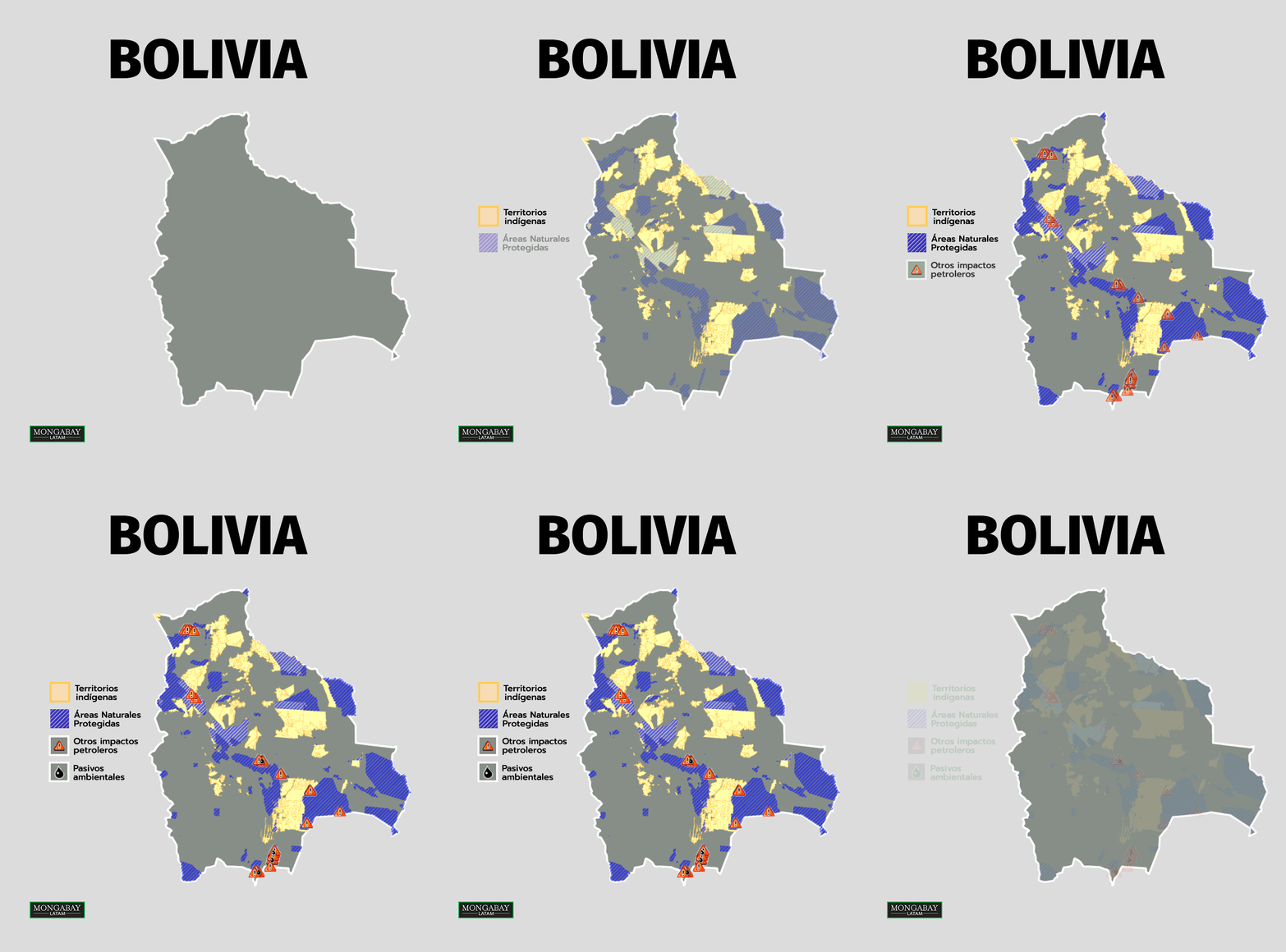
According to the environment ministry, Bolivia has 130 protected areas, including 14 national parks, and allows oil activities in these natural areas. This has turned Bolivia into the country with the most natural reserves affected by oil waste. At least seven oil wells are located in three protected natural areas: five of them in the Serranía del Aguaragüe National Park and Integrated Management Natural Area (Tarija), one in the Carrasco National Park and Wildlife Sanctuary (Cochabamba) and one in the Tariquía National Flora and Fauna Reserve (Tarijia). In addition, 36 oil wells overlap with seven protected areas: 17 in Aguaragüe, five in Manuripi, five in Carrasco, three in Tariquía, three in Kaa-Iya del Gran Chaco, two in Madidi, and one in Amboró. It should be noted that although the Ministry of Environment and Water claims there are 94 wells, it was only possible to confirm the location of these 42 wells through georeferencing.

“Governments and companies don’t really understand the environmental impact that so many spills from waste pits and pools can have,” says Nicolas Mainville, a biologist with Amazon Frontlines. “And something we’ve seen for years in Ecuador and Peru is that pollution migrates, moves and above all enters the food chain of Indigenous peoples. We have to stop thinking of pollution affecting just one place: The whole Amazon basin is connected by the migration of fish and other animals,” he adds.
The most worrying case is that of the Serranía del Aguaragüe National Park and Integrated Management Natural Area, in the Bolivian department of Tarija. This protected area, which was visited by a team of journalists for this investigation, has the highest concentration of environmental liabilities in the country, five out of seven — and none of them have been remediated, according to information obtained from the National Environmental Information System. In this same park there are 17 oil wells that are not considered liabilities.

Jorge Campanini, researcher at the Bolivian Documentation and Information Centre (CEDIB) speaks about some of the problems affecting communities in Aguaragüe. “There are reports of infections and diseases, and some do not even have access to water because it is contaminated.”
The second-most-affected country is Ecuador. Although Chevron-Texaco’s environmental liabilities do not overlap with protected areas, 50 oil damage sites, to which the government refers as “sources of contamination,” were found in five protected natural areas. Yasuní National Park, located in the department of Orellana, is home to 30 of them.
In the Peruvian Amazon, there is an environmental liability in the Yanesha Communal Reservation and 14 “impacted sites,” as the government calls other oil damage, in the Pacaya-Samiria National Reserve. Meanwhile in Colombia, an “unresolved liability” can be found in the Serranía de los Yariguies protected area, in the department of Santander.
The situation in Peru could worsen as the Ministry of Energy and Mines recently submitted to the Ministry of Environment a bill proposal that seeks to modify the Law of Natural Protected Areas, which would encourage oil and gas exploitation in these territories. Civil society organizations, such as DAR, say this proposal would weaken the legal framework for protecting natural areas by prioritizing extractive activities over the conservation of biological diversity in these areas, contrary to what is established in the country’s Constitution.
“National parks, as well as national and historical sanctuaries, make up the so-called ‘protected natural areas (ANP) of indirect use’, in which, due to their high value and fragility, the current legislation prohibits the extraction of natural resources and transformations of the natural environment,” warns DAR.
Oil pipelines crisscrossing the Amazon
Something that increases the risk of pollution is the hundreds of kilometers of oil pipelines that cross Indigenous territories and protected natural areas. A geographical analysis revealed that there are more than 2,897 km of pipelines in 205 Indigenous territories and natural reserves in Bolivia, Colombia, Ecuador and Peru.
The Indigenous territories and protected areas in these countries hold 11% of all oil pipelines, a total of 65 natural reserves and 140 Indigenous communities. Most of the communities are in Peru (58) and Ecuador (58). In Peru, the communities crossed by more than 20 km (12.4 mi) of pipelines are José Olaya (33 km or 20.5 mi), Pucacuro (29.23 km or 12.57 mi), Boca del Copal (26 km or 16.2 mi), San José de Nueva Esperanza (21.93 km or 13.6 mi), Kuyuntsa (20.47 km or 12.7 mi) in Loreto and Belisario Ramon Asencio Porcuya (22.04 km or 13.7 mi) in Piura. Meanwhile, in Ecuador, native communities with more than 20 km of pipelines are Waorani (68.44 km or 42.5 mi), Tipishca (39.73 km or 25 mi), Yamanunka Territory (24.45 km or 15.2 mi) and an unidentified one (83.853 km or 52 mi), which are located in the Zamora Chinchipe, Pastaza, Sucumbios and Orellana provinces.

In the protected natural areas, we identified more than 971 km (603 mi) of pipelines crossing 65 natural reserves in Peru, Colombia, Bolivia and Ecuador. Katherine Casas, of Crudo Transparente, points out that there is a lot of environmental damage in Colombia caused by the hydrocarbon industry. “The damage has reached protected areas and Indigenous territories where there is a lot of oil activity.” Colombia alone has 50 natural areas that are crossed by more than 512 km (318 mi) of pipelines.

Some of the most-affected areas are Salamanca Island, the San Silvestre wetlands, Serranía de los Yariguies and the Zapatosa Cenozo Complex in Colombia; the Río Grande Valles Cruceños Integrated Management Natural Area (ANMI), the Cactaceae Garden, the Aguaragüe National Park and Integrated Management Natural Area, Lomas de Arena, and Carrasco in Bolivia; Cayambe Coca, Yasuní and Antisana parks, as well as the Cuyabeno Fauna Production Reserve, in Ecuador; and the Pacaya Samiria National Reserve in Peru.
Papoulias, who investigated the oil damage caused by Blocks 192 and 8 in the Peruvian Amazon, says she has seen firsthand over many years how oxbow lakes and large bodies of water have received “produced water” discharge, which includes hydrocarbons and heavy metals, as well as frequent oil spills. “The material has sunk to the bottom and remained in the sediments, and these contaminants then enter the food chain. In addition, every year the pollutants are moved around and dispersed by rainfall. This is not guesswork, it is something we know, thanks to real data that we have collected.”
Source : Mongabay


